Infrastructure Investment As A Catalyst For Urban Transformation; 5 Major Projects Redefining Singapore
In a recent survey by Mercer, Singapore was ranked the top global city (out of more than 200 cities around the world) in terms of offering the best infrastructure.
In the same survey, Singapore ranked as the top Asian city in terms of the overall quality-of-living survey. This high quality of infrastructure and high standards of living have resulted in Singapore becoming a vibrant city and an important global business hub.
The Government of Singapore realized early on that city infrastructure is an important factor when multinational corporations decide where to establish operations abroad and where to send expatriate workers and therefore, has been at the forefront of funding and building infrastructure over the past fifty years and more, since its independence.
It continues to do so with a view to the long term success and sustainability of this tiny island nation that is smaller than the area of New York City.
1. Water Infrastructure: Singapore River and Marina Bay
Similar to the redevelopment of Yarra River in Melbourne, Singapore embarked on the clean-up and redevelopment of the Singapore River in the late 1970s.
This resulted in the transformation of the riverfront from a polluted, overcrowded, and blighted area to a mixed use hub of activity that is a magnet for both tourists and locals.
The precincts of Boat Quay, Clarke Quay, and Robertson Quay along the river have been meticulously planned as a mix of historic and new developments and are now highly sought after for dining, entertainment, recreation, and living.
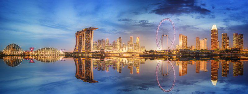
The transformation of the riverfront along with land reclamation has led to the creation of the world renowned Marina Bay district – a distinctive and global location for business, living, working, and leisure.
Marina Bay was reclaimed in the 1970s and 1980s in anticipation of the need to grow the city centre in the future.
Marina Bay allows for the seamless extension of Singapore's Central Business District and further supports the city-state's continuing growth as a global business and financial hub.
It is planned as a vibrant, mixed-use district with round-the-clock activities based on sustainable development strategies. The next phase of development includes a new lively and mixed-use residential district at Marina South that is planned to be green, walkable and cycle-friendly.
2. Port Infrastructure: New Tuas Mega Port
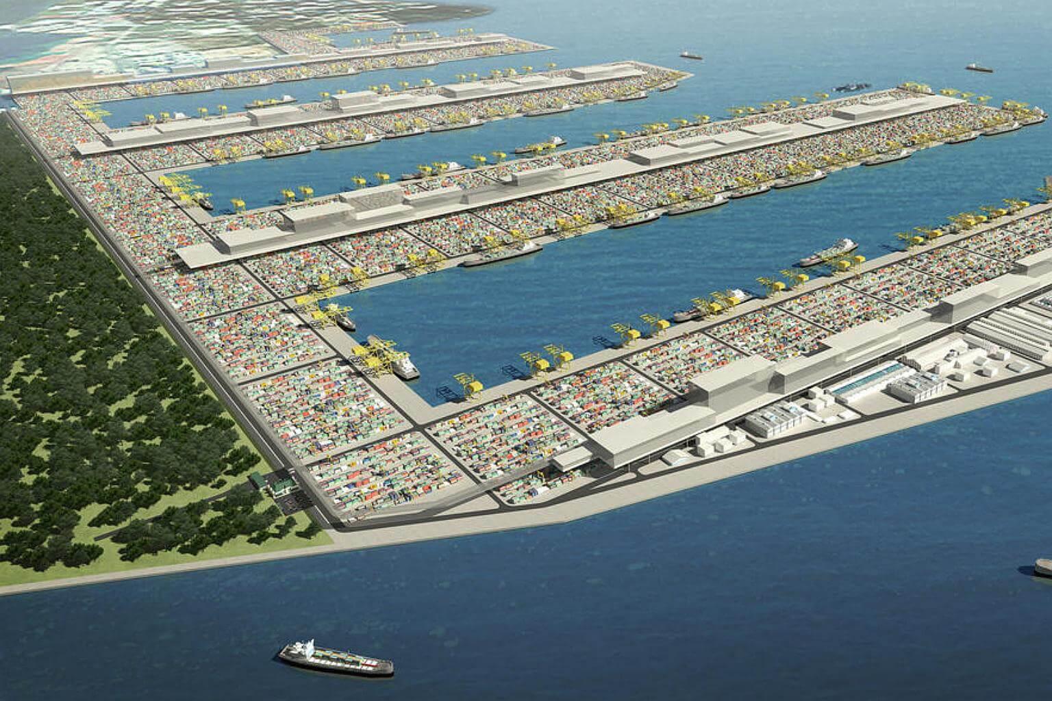
On the opposite end of the CBD from Marina Bay, plans are underway to relocate the existing port terminals to free up about 1,000 hectares of land - three times the size of Marina Bay.
The planned relocation of the City Terminals and Pasir Panjang Terminal to the Tuas mega port (close to the border with Malaysia) will lead to the creation of the Greater Southern Waterfront.
The first set of berths at Tuas Port will be operational in 10 years’ time, and the City Terminals will be phased out by 2027. The areas now occupied by the City Terminals and Pasir Panjang Terminal presents a redevelopment opportunity of enormous potential.
Greater Southern Waterfront represents an opportunity to create a new waterfront city that is seamlessly integrated with the downtown and surrounding housing and businesses near the city.
Greater Southern Waterfront is envisioned for new housing, commercial, cultural and entertainment uses, cementing Singapore’s growing reputation as a world-class city for its people to live, work and play.
To meet Singapore’s plan to achieve water self-sufficiency and maximize the public investment involved in the port relocation activities, the Public Utilities Board of Singapore is proposing a reservoir that could retain rainwater from the Greater Southern Waterfront and store excess water from the Marina Reservoir.
To leverage this, the master plan integrates a network of canals, lined with shops and cafes, running through the new neighbourhoods comprising low- and mid-rise developments.
An artist's impression of the Tuas mega port. PHOTO: MPA3. Green Infrastructure: Rail Corridor
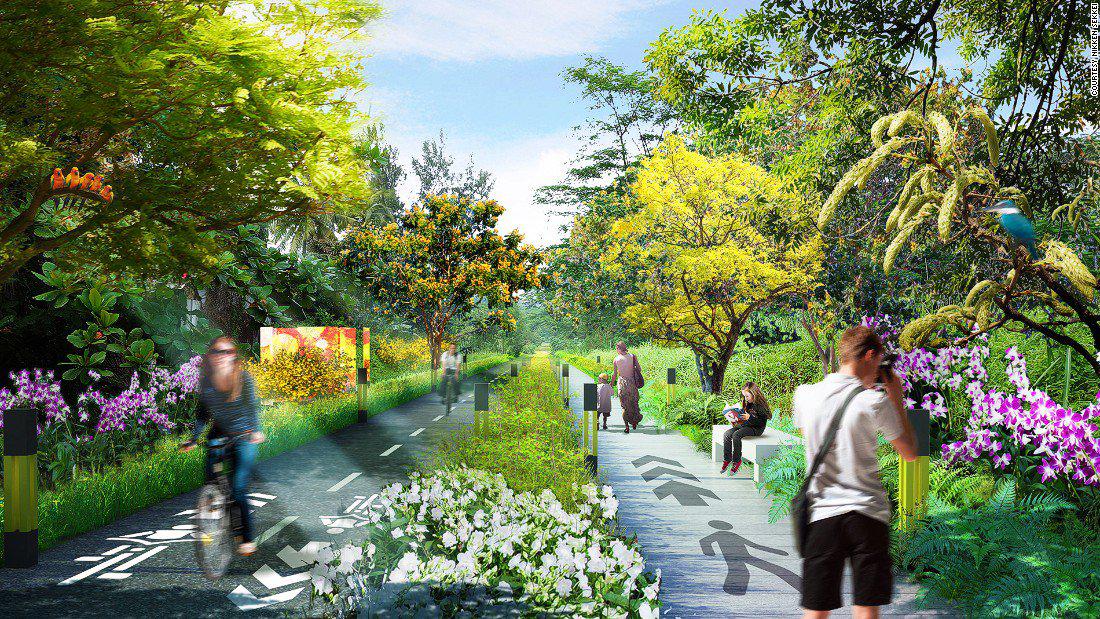
The Greater Southern Waterfront master plan also proposes an eco-corridor that will provide an unbroken ecological connection that links the famous Gardens by the Bay to the island-wide green network, including the adjacent Rail Corridor.
The Rail Corridor is 24 kilometres long. As a “green corridor”, it will provide an oasis and a place of relief against the increasing density and intensity of urban living.
By virtue of its length and reach, the Rail Corridor is a very unique public space differentiated from other community spaces in Singapore.
The Rail Corridor connects homes, work places and schools. It encourages a spirit of discovery and exploration, and provides a common space for shared experiences across a diverse segment of our population. It has great potential in fostering social-bonding and community-building activities along its length.
The return of the former railway land from Malaysia presents a unique opportunity for Singapore to pursue innovative ways to green the city and strike a balance between competing needs in the urban environment.
Stretching as an almost seamless corridor from Woodlands (on the Malaysian border) in the north to Tanjong Pagar (adjacent to the CBD and Greater Southern Waterfront) in the south, the Rail Corridor will be part of the future150 km Round Island Route and the larger Park Connector Network. Embedded in this corridor will be inviting public spaces for community interaction, activities and events.
4. Rail Infrastructure: High Speed Rail to Malaysia
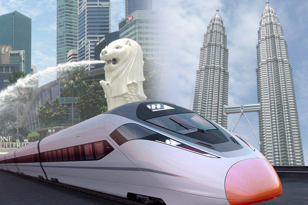
To replace the former rail connection between Singapore and Malaysia, a High Speed Rail (HSR) link is planned to be operational by 2026.
HSR is a strategic project between the Governments of Malaysia and Singapore that aims to facilitate seamless travel between the two capital cities, enhance business linkages, and connect the peoples of both countries closer together.
With terminus stations in Kuala Lumpur's Bandar Malaysia and Singapore's Jurong East, the HSR link is expected to cut the travel time between the two cities to 90 minutes compared with more than four hours by car.
Decentralisation is a key strategy for Singapore to relieve the pressure off the city centre and to provide jobs and opportunities closer to homes outside the city centre.
Jurong East is one such regional center that has been identified for this purpose. Jurong East together with Jurong Lake offers an exciting opportunity to be developed into the biggest lakeside destination for business and leisure.
The two are jointly known as the Jurong Lake District (JLD). The 360ha JLD will feature two distinct precincts: a vibrant commercial area (Jurong Gateway) and a waterfront leisure destination (Lakeside). It is categorized as Singapore's second central business district.
JLD will consist of a core area around the HSR terminus that comprises high-quality office spaces with mixed-uses.
This core area will be surrounded by clusters of new business parks that provide flexible and adaptable work spaces for a good mix of complementary businesses and services of varying sizes and cater to their evolving needs in the future economy.
It will be an inclusive and vibrant place that not only caters to the needs of businesses and visitors, but also residents of different backgrounds and the wider community.
JLD will be a vibrant 24/7 hub that offers retail, entertainment and leisure options outside working hours, as well as quality new homes, inclusive public spaces, and recreational facilities for the community to enjoy.
Further, it will be a district with minimal car usage, and comprise a more aggressive public transport mode share that is higher than the national target of 75 per cent by 2030.
Composite image by CH2M5. Airport Infrastructure: Changi Airport
Awarded the World’s Best Airport Award for the fifth consecutive year by Skytrax, Changi Airport is set to become even bigger.
As the world’s sixth busiest airport for international passenger traffic it is set to expand to a capacity of 135 million passengers per year by around 2025, cementing Singapore’s status as one of Asia’s leading hubs.
Plans for the expansion through construction of the new Terminal 5 (T5), to be built on an unused 1,080-hectare site at Changi East. Set to be one of the largest terminals in the world, Terminal 5 will be capable of handling 50 million passengers per annum in its initial phase.
Terminal 5 will be connected to Terminals 1 to 3 to allow the expanded Changi Airport to be operated as a single, integrated airport without compromising on the ease of transfer between different terminals, passenger convenience and airfield operational efficiency. The terminal will also be connected to the Singapore’s Mass Rapid Transit (MRT) network.
As part of the Changi East project, a three-runway system will also be implemented, to increase Changi’s runway capacity. An existing third runway, currently used by the military, will be extended to handle larger passenger aircraft.
To support the long-term growth of the logistics and aerospace industries, an industrial zone will also be developed, for airfreight and air express operators as well as MRO activities.
Current Changi capacity is 66 million, which will increase to 82 million in 2017 with the addition of Terminal 4 (T4), now under construction.
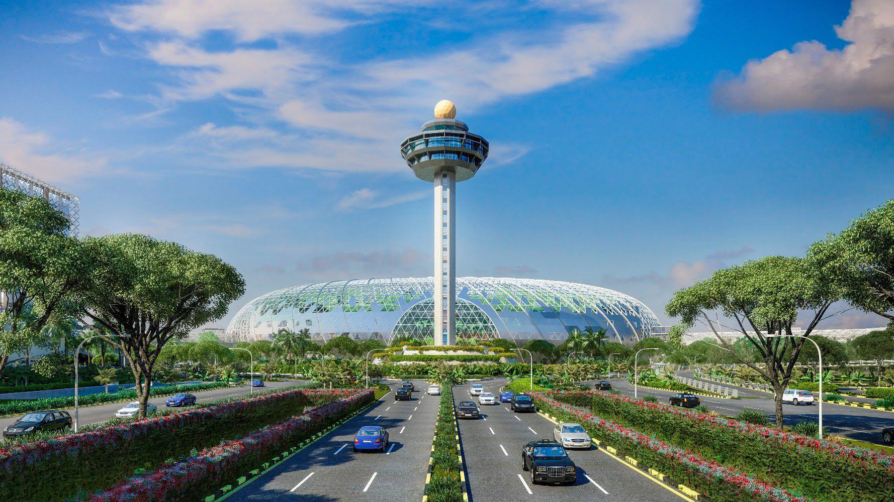
A mixed-use area, Jewel Changi Airport, a joint venture between CAG (51 percent) and CapitaLand (49 percent), is expected to open in 2018 adjacent to Terminal 1.
The development, with retail space, a hotel and facilities for airport operations, will have a total gross floor area of about 134,000 square meters, and 10 floors, with five levels below ground for parking.
Creating Economic Opportunities For Singaporeans; Why Infrastructure Plays Such A Pivotal Part In The Future Of Cities
Determined and well thought out investment in infrastructure has made Singapore into a benchmark and a model to look up to for cities in the Asia Pacific region and beyond. This investment coupled with long range city planning has led the city-state to attract and create economic opportunities for the businesses and people that call Singapore home. Further, these investments are laying a strong foundation for tomorrow’s Singapore while ensuring that it remains globally relevant and is a pioneer of the next generation.

About the Writer – Rahul Mittal
Rahul is a recognised leader in his field and director at Cistri, renowned for working on major urban redevelopment projects around the globe. He brings to Cistri more than fifteen years of in-depth consulting experience in master planning, urban design and landscape architecture. Over the course of his career Rahul has worked on major projects around the world, spanning the USA, India, China, Japan, and multiple countries in Southeast Asia.


