How 3D Technology Can Improve Community Engagement
We are now living in a world where communities are both better informed and more conscious of their surrounding environments.
Citizens have become guardians of the character and history of an area, and this can influence whether a local infrastructure project moves forward. Or not.
What does this mean for urban planners and developers? The obvious answer is that they need to scope, plan and execute on projects with community impact firmly in mind, and furthermore, they need to do so with effective communication and exchange.
If you’re thinking “pfft…eye roll” consider this: There’s about $20 billion of infrastructure projects in the last decade that have been either paused or cancelled due to community opposition.
Much of the opposition, which has stymied projects since 2009, boils down to a lack of transparency and community inclusion.
Note that the demand for community engagement is broad, not limited to a vocal few. In fact, 80 per cent of Australians indicated it is important that government considers the views of the community when planning or investing in major infrastructure.
A growing problem
Sufficient infrastructure is an increasingly urgent issue, driven by Australia’s population growth. Infrastructure Australia says the population is projected to grow by 24 per cent, to reach 31.4 million by 2034. Right now, however, infrastructure is already failing to keep pace in our four largest cities.
Various attempts to address the trend involve large sums of money, including pledges by the federal government of $100 billion investment in infrastructure. None of that matters if, later down the line, urban planners and developers can’t clear the community endorsement hurdle.
Open, effective, and informed consultation is essential. If future benefits of projects aren’t fully explained, and community feedback not addressed, projects will falter.

Just got real
Genuine engagement takes place right from the start, by taking the community into consideration during the scoping and planning phases. Optioneering and analysing the impact on a project’s surrounding area is absolutely essential. Without such meaningful actions, communication and exchange is limited at best and worst, a shallow afterthought.
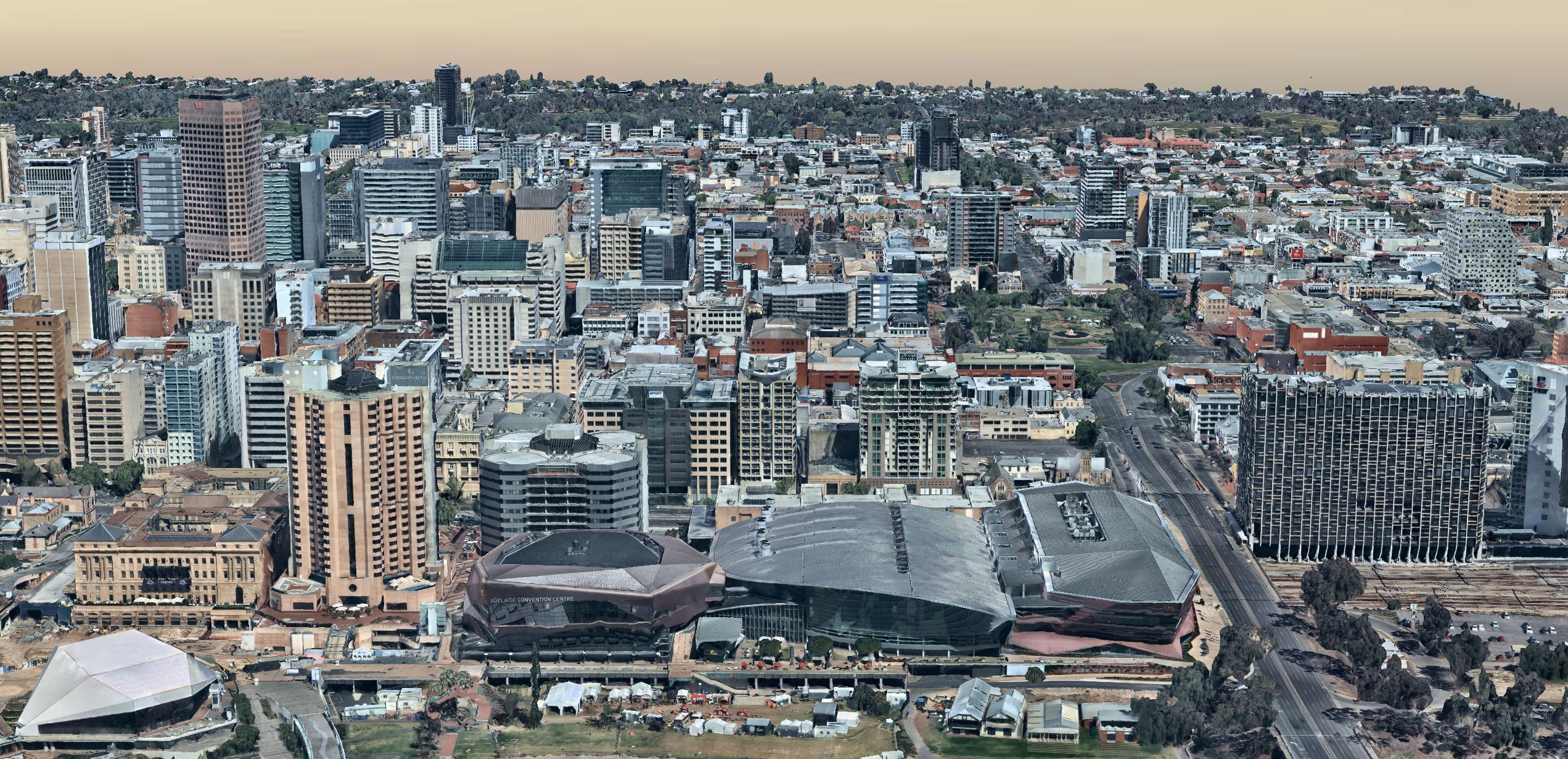
At Aussie tech pioneer Nearmap, we solve this type of challenge with technology. In particular, technology that offers the insights urban planners require to analyse and plan effectively, and the immersive experience citizens and stakeholders need to fully understand a project. I’m talking about 3D models—or to be more precise, up-to-date, on-demand models of Australia’s urban environment.
With real-world context, users in architecture, construction, engineering and government, get a holistic view of a project area and its surroundings. They can superimpose a proposed structure in the 3D environment, inspect what it would look like, analyse various scenarios, and consider which option works best.
By bringing a project to life in 3D, they can immerse all stakeholders, including citizens living in the area, in the future of their neighbourhood.
The community can more easily explore the potential impact on the environment, assess changes required, and have their say. Rather than stakeholders and community members worrying about shadows falling over nearby parklands, an up-to-date 3D representation can help allay concerns or visualise alternatives.
New tech for a new Australia
Australia is changing. The G20’s Global Infrastructure Initiative estimates the country will invest US$1.5 trillion in infrastructure by 2040, resulting in thousands of new projects across every aspect of the economy. To ensure this investment is well planned, accepted by the community, and ultimately successful, technology like 3D imaging is vital.
3D isn’t new, but historically, the ability to readily and easily access 3D imagery has been limited. With Nearmap 3D, we solve this with an on-demand model, like so many of today’s “as-a-service” business applications.

Firstly, up-to-date 3D models of Australia’s major urban areas are instantly accessible via a lightweight web application. Urban developers can easily search and explore a location from multiple perspectives, measure distances in-browser and select an area to download.
Secondly, let’s consider that word “download”. The export capabilities of Nearmap 3D are a game-changer, allowing planners and developers to get hold of 3D content and bring it into their workflow quickly. Very quickly, in fact.
Time is of the essence
With prime minister Scott Morrison expressing concern Australia is “starting to hit our head on the ceiling in terms of how much infrastructure work you can get under way at any one time”, time is of the essence for every project.
Previously, 3D images took days or weeks to access via a hard disk. The return on investment of producing such images was harmed by the time lost waiting for the latest changes to be made and delivered. At Nearmap we’ve now shrunk this time to a matter of minutes for most downloads, and a few hours for large areas. This means urban planners can fast-track the tender process and start working on a project almost immediately.
Once equipped with 3D datasets, further productivity gains kick in. With a real view of what’s on the ground, scoping and planning become more effective and it’s much easier to anticipate potential roadblocks and identify special requirements.
3D representations help foster stakeholder and citizen involvement, making concepts and proposed designs a little more tangible for discussion. In fact, positioning the overall conversation against a backdrop of reality.
Remember those projects languishing, for want of community support? Stakeholders and citizens not only need to be involved early on, but immersed in real-world context for genuine community engagement. Fulfilling the potential of Australia’s infrastructure investment depends on it.
Learn more about Nearmap 3D.
Contributed by Shane Preston, executive vice-president at Nearmap.
The Urban Developer is proud to partner with Nearmap to deliver this article to you. In doing so, we can continue to publish our free daily news, information, insights and opinion to you, our valued readers.


